After the Korean War, the Demilitarized Zone became the buffer between the two countries. The DMZ was created in July of 1953, when North and South Korea signed an armistice agreement that effectively ended the Korean War.
 |
| Welcome to the hostile border between two warring nations, now a famous tourist attraction! |
The name "Demilitarized Zone" is a bit of a misnomer, since between all the land mines and soldiers it's actually the most heavily militarized area in the Korean peninsula. The DMZ stretches from coast to coast (about 160 miles/250 kilometers) and is 1.5 miles/4 kilometers wide.
 |
| Demilitarized zone, sounds safe! Oh wait, what does that little red triangle on the barbed wire say? |
 |
| Oh, mines and barbed wire. Sounds very demilitarized to me. |
This blog entry will mainly be about the DMZ and Joint Security Area (JSA) tour that I took, but in the very near future I will be writing about the surprisingly-interesting Korean War and the fabulous Korean War Memorial museum, so get excited about history.
In the meantime, this is the itinerary of the tour I took with the USO:
9:00am Leave the Camp Kim USO (Seoul)
10:00am DMZ Theater & Third Infiltration Tunnel
11:00am Dora Observatory & Dorasan Station
12:00pm Lunch
1:00pm Camp Bonifas Briefing & JSA Tour
3:00pm Depart for Camp Kim
 |
| In front of an artistic piece about unification at the Third Tunnel/DMZ Theater. The lady on the left kept giving me dirty looks because I stepped into her photo, but I gave her a solid two minutes alone up there before I got impatient. Darn Chinese tourists. |
The tour started at the DMZ Theater, which is a small building with some signs in poor English and a few well-crafted but otherwise uninteresting models of various DMZ areas. The highlight of the DMZ theater was a stereotypical Korean short film, which, while narrated in English, thankfully retained all the gusto and drama of the original Korean version. The intense music and vintage war footage was played on six screens that sometimes played the same thing and sometimes became one very long screen, which was a bit hard to keep up with. After a 7-minute video, we were led outside to the tunnel.
 |
| Have I mentioned that everything has cute mascots in this country? Even tunnels created to invade the country. EVERYTHING. |
In 1978 the Third Tunnel of Aggression, as it is known by South Koreans, was discovered just 27 miles/44 kilometers from Seoul. It was found based on information from a North Korean defector. So far four tunnels have been found, most recently the Fourth Tunnel in 1990. Korean and U.S. military forces are still searching for more, as there are estimated to be around 20 more undiscovered tunnels. Each of the known tunnels is large enough to allow 2,000 soldiers (one regiment) per hour to pass into South Korea.
North Korea claims the tunnels were abandoned coal mines, but there are a few problems with this excuse. First, there is not and has never been coal found in this area, only granite. Second, there are yellow dynamite marks on the walls, and the use of dynamite would be a little counter-productive for mining coal. North Korean soldiers did, however, smear coal powder on the walls of the tunnel to give the appearance of coal mining. Third, the tunnels are built to slant ever-so-slightly downward in the north, so that water does not collect or stagnate on the southern side. Nice one, North Korea.
 |
| The entrance to the Third Tunnel of Aggression. This is as far as a camera is allowed to go. |
Cameras are not permitted in the tunnel, but frankly, there's nothing to photograph in there anyway. Basically you walk down a steep incline until you're 73m (240 feet) below ground--that's a long walk, by the way--then you walk through a claustrophic, damp tunnel until you hit the end, and then you turn around and walk back up. The tunnel was crowded, uncomfortably warm, and full of Chinese tourists who apparently feel that they are exempt from the no-photos rule. It was 100% uninteresting and I'd recommend skipping it.
They say that the tunnel is 2m wide and 2m tall (about 6 feet) but that's a bald-faced lie. I'm 5'2" (155cm) and I hit my head a few times. Pictured above is the entrance to the tunnel, and let me tell you, those helmets aren't just some touristy gimmick. They actually provide necessary protection for the heads of tall people. The only part of the tunnel experience that made it worth anything was watching all the tall western folks crouching down in weird positions to walk through. Hilarious!
After the theater and tunnel, we hopped back on the bus and drove to the Dora Observatory. This is a lookout on a hill that allows you to see into North Korea.
 |
| The Dora Observatory building. We didn't go inside. |
It's a nice view, although you're not allowed to take photos from anywhere good. I got excited and completely failed to notice the no-photos line. I got scolded and the other people on my tour laughed and playfully accused me of pulling a Chinese Tourist. (I didn't, by the way. I really didn't notice the line. It's only a Chinese Tourist play if you purposely ignore the signs and pretend to not speak any intelligible language when someone tells you not to take pictures.)
 |
| There's the photo line. I honestly did miss it. Despite being bright yellow. :( Photo by http://stepyou.wordpress.com/. |
I did get a few pictures from behind the line by holding my camera over my head.
 |
| See that flag right in the center? It's the tallest flag in South Korea. |
 |
| Do you see that snaky line in the middle-left of the photo? That there is the DMZ itself, the actual line. |
The bit of civilization you can see in the photo below is Gaesong Industrial Complex. It was opened in 2004 as a beacon of peace and cooperation between North and South Korea. South Korean companies wanted to take advantage of the North Korean manufacturing labor force. There were significant benefits to using North Korean labor instead of Chinese labor; the workers were cheaper, educated, and (most importantly) spoke Korean. As of June 2010 there were 110 factories in the Complex, employing 42,000 North Korean workers and about 800 South Korean staff. The park was expected to supply over 700,000 jobs by 2012, but cooperative ties ended in 2010 after the ROKS Cheonan incident. (If you want to read more about the ROKS Cheonan incident, you can scroll to the bottom of this post or click here to jump there. Don't worry, you can jump back!)
 |
| The area with trees is South Korea. Where there are no trees is North Korea. |
After the Dora Observatory, it was off to Dorasan (Dora Mountain) Station. This station was built to connect North and South Korea to the rest of the Asian continent in an ambitious rail system. Instead of normal Korail (Korean Rail) employees, the station is manned by unusually friendly soldiers. Apart from them, it's completely empty.
 |
| The outside of the station. It's super clean and new and nice. And empty. |
 |
| This is the customs area. It's got x-rays and all the fancy stuff. Nobody is using it. |
Here's a picture of the planed Trans Eurasian Railway Network. If it were completed, it'd certainly be impressive. With this rail system, you could potentially travel from Busan (the southern tip of Korea) all the way to Portugal by train, and from Japan to Britain if you used a ferry. This would probably be more cost-effective for cargo rather than people, but it's an incredible idea.
 |
| I would ride from end to end just to say I did. There's definitely a market for that, TERN guys. Get on it. |
It's unclear whether or not the train still goes into North Korea. Some sources say that a train still goes a few times a week to carry supplies to the Gaesong Industrial Complex. My tour guide said that we had to get off the tracks because a train was coming, but I'm about 90% sure he was joking. His English was excellent, but jokes from non-native speakers are often hard to catch.
 |
| It's kinda surreal to think that at some point I could potentially travel through Pyeongyang, the capital of North Korea. |
You can't get on an actual train at Dorasan Station, but you can pay W500 (that's about 50 cents) to get a souvenir train ticket and go check out the platform. It's basically like any other subway platform, except that you get to stand on the tracks. Very touristy.
 |
| Look at this cute old man stamping tickets! |
So of course, I had to do it. I only had W300 in my pocket, so a nice lady in my tour group gave me the extra two coins to get my ticket. Good thing, too, because otherwise I'd have been the only person who didn't go onto the platform.
 |
| Look at all the stamps! |
And some touristy photos from the platform:
 |
| The DMZ is actually quite close to Seoul. |
 |
| Like I said, the soldiers were super friendly. Here's a photo of me with Soldier Moon, and my only regret is that he wasn't a sailor. But I've still got time to find Sailor Moon, so I'll keep searching! |
After Dorasan Station we went to the adjacent Highway Authority building (not sure if the highway refers to the roads or the rail lines, maybe both) which is beautiful and new and totally empty save for a souvenir shop and a restaurant. The restaurant is named "Good Restaurant." No joke. You can choose between bulgogi (that's sweet Korean beef) and bibimbap (rice with a variety of veggies and sometimes meat.)
 |
| In case you're not sure what bulgogi is, this is it. When it's good it's delicious, but when it's bad it tastes a bit like the fatty, chewy bits of cows that McDonalds rejected. Word to the wise: NEVER EVER EVER order anything that has bulgogi in it, such as a bulgogi bake (Costco) or bulgogi burrito (Taco Bell.) Photo not mine, source unknown. |
 |
| This is bibimbap. Under all those veggies is a big pile of rice; the veggies just barely cover the rice. Cheap bibimbap doesn't even come with an egg or mushrooms. Photo not mine, source unknown. |
For some reason foreigners seem to have an aversion to bibimbap, probably because it's the go-to cheap and safe meal to feed to foreigners. It's not spicy, it has no strange flavors, and it's often vegetarian. Nobody dislikes bibimbap, we're just sick of it. I went with the bulgogi, which came with a variety of sides that were all a bit strange, even by Korean standards. They included fish chunks (that looked suspiciously like fried chicken), bite-size sausages, scrambled eggs, sweet fried bread triangles, sour kimchi (yuck), and lots of rice. The bulgogi itself wasn't very good either. My advice: bring your own meal on the tour.
With lunch over, it was time to head to Camp Bonifas, which is just 400m from the southern boundary of the DMZ.
 |
| I wasn't allowed to take a photo out here, but here's one from Wikipedia. |
Once inside the camp and safely into the tourist building, we were once again allowed to whip out our cameras and check things out. There's a small museum on the second floor, while the first floor comprises a gift shop and a briefing room. We were ushered into the briefing room and made to sign a liability waiver that essentially said that the JSA was dangerous and that nobody was responsible should we be injured, killed, or dismembered. Goody.
 |
| Quick! Name every flag's nation! I can't do it. All those European ones are confusing. |
Our briefing, which was given by a young Army dude who admitted that it was his first time giving the presentation--he did a great job, actually, it's a rather long presentation to memorize--told us not to wave, point, or otherwise communicate with the North Koreans. Because they might shoot you. Fair enough.
Then we were herded into special Camp Bonifas buses and taken to the Joint Security Area (JSA). This was by far the coolest bit of the tour.
 |
| Oh heyyyyy there, North Korea! |
Here's a photo I definitely didn't take, since it was taken from the North Korean side. Those people are a tour group--that's where I was. Keep in mind that you are looking south from North Korea in this photo.
- The east-most grey building (on the far left in this picture) is KPA (Korean People's Army, that's North Korea) Recreation Building, which is a misnomer in that it doesn't actually house any recreational equipment; instead, during talks North Korean soldiers will stand inside and make throat-slashing gestures through the windows.
- The east-most (left-most) blue building is the Joint Duty Officer (JDO) Conference Center, and frankly I don't understand what this building is for.
- The middle blue building is the Military Armistice Commission (MAC) building, which is the one I went into and where peace talks are conducted.
- The west-most blue building (right in this photo) is the Neutral Nations Supervisory Committee (NNSC) building.
 |
| Excellent photo taken by Brian McMorrow. |
The NNSC once comprised four nations that did not take part in the Korean War. South Korea chose Switzerland and Sweden, while North Korea picked Poland and Czechoslovakia. However, North Korea dropped their NNSC countries after both countries democratized in the early 1990's, so now only Sweden and Switzerland are left. There are six delegates from each country, and their only real purpose now is to show that the U.N. really does care about the armistice.
The JSA was once a totally shared area, but after the Axe Murder Incident boundaries were set up for the North and South Koreas. The blue buildings are for meetings, and are placed exactly in the middle of the boundary line, so half is in North Korea and half is in South Korea. Inside are chairs and tables for talks.

 |
| See the KPA (North Korean) soldier on the steps? |
 |
| KPA soldier, close up. |
Inside the MAC building:
 |
| There's a U.N. flag on the main table. The other side of that table is in North Korea! |
All Korean men are required to serve in the military for 2 years, but it doesn't have to suck. If a man's English skills are good, he can apply to become a KATUSA, or Korean Augmentation to the United States Army soldier. KATUSAs work with American soldiers, and are more respected and get better treatment than their regular counterparts.
To serve at the JSA, however, the requirements are even more stringent. Each soldier must have a black belt in either Tae Kwon Do or Judo. He must also be at least 170cm (5'5") to serve there, although I can tell you that every soldier there (American too) was significantly taller than that. I've heard from Koreans that the military puts very tall soldiers on the DMZ in order to look more intimidating. To look even more intimidating, the soldiers wear sunglasses and must maintain a stiff posture and clenched fists at all times. I mistook the first one I saw for a statue!
 |
| This dude is intimidating. He's like a statue. |
The soldiers stand with half of their bodies hidden behind buildings and half visible to the North Korean soldiers. This has two purposes. First, it makes them a smaller target should the KPA guys start shooting. Second, it allows them to discreetly give hand signals to other South Korean soldiers without being seen by North Korean soldiers.
|
| Looking sharp in those uniforms! Korean girls don't believe me when I say that American women have a thing for men in uniforms. |
Another shot of that North Korean soldier, he looks a bit lonely.
 |
| Although I think I saw him talking to someone in that window behind him. |
 |
| This main guy up front spoke great English. I accidentally took a picture of something I should haven't, and he very politely asked for my camera and deleted the picture. If only everyone was so polite! |
And now for a few obligatory tourist shots of me with South Korean soldiers. This dude is barely breathing, it's incredible. Honestly they could have just replaced him with a statue, I'd never know the difference.
 |
| Only 5'5"? I don't think so, buddy. |
Also, these pictures? Taken in North Korea. This is the North Korean side of the MAC building! Yeah, there's another country to cross off the list. (Because this is as far into North Korea as I plan to go on my own free will.)
 |
| Did I mention we had to wear security badges? Mine's right about the camera. (If you're wondering how I got this picture with my camera on my neck, the answer is: I have two cameras! I give people my less expensive point-and-shoot because honestly, people drop it more often than I'd like.) |
 |
| Obligatory peace sign! |
 |
| Safely back in South Korea, phew! |
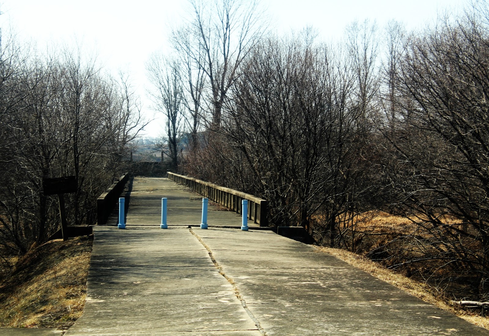
After seeing the main buildings, we piled back into the bus and took minute-long drive to Checkpoint #3, which overlooks the Bridge of No Return. It got this name in 1953, when prisoners of war from both sides were taken to the bridge and told that they could cross it, but once they crossed they would be unable to re-cross it.
 |
| Bridge of No Return! Sounds very cool. |
Finally, it's time to tell you about the Axe Murder Incident. See that little blue guard post down by the Bridge of No Return? This was the former Checkpoint #3. There was a big poplar tree in front of it that blocked the view in one direction. The South Korean/American forces called in some tree-trimmers to trim the tree, but the North Koreans got mad. Some arguing ensued. at which point about 20 North Koreans attacked. They grabbed axes dropped by the frightened tree-trimmers and killed two American soldiers, Army Captain Arthur G. Bonifas and First Lieutenant Mark T. Barrett.
After the Axe Murder Incident, the South Korean and American forces knew they had to cut down the darn tree, and so began Operation Paul Bunyan, also known as Task Force Vierra. Operation Paul Bunyan required:
- 23 American and South Korean vehicles...
- ...filled with two eight-man teams of military engineers equipped with chain-saws,
- two 30-man security platoons from the JSA, armed with pistols and axes,
- detonation systems on the Freedom Bridge,
- a 165mm gun mounted on a car to shoot the bridge in case the explosives failed,
- rafts on the nearby river in case emergency evacuation was necessary,
- a 64-man South Korean Special Forces team, armed with clubs and masters of Tae Kwon Do,
- M-16 rifles, grenade launchers, and mines,
- 20 utility helicopters and 7 Cobra attack helicopters,
- B-52s (that's a bomber), escorted by F-4 Phantom II's and F-5 Freedom Fighters (jets), and
- more troops stationed nearby, just in case.
A total of 813 men took part in Operation Paul Bunyan, which had exactly one goal: cut down a poplar tree.
The tree, sans its branches, stood in its place for a long time, but it's been cut down and replaced by a plaque commemorating the event. Seriously. I have not made up a word of this. Basically, The Axe Murder Incident is a ridiculous tale about men getting angry over some landscaping.
 |
| A closer look at the Bridge of No Return. The abandoned Checkpoint station is on the left, out of view. |
Additionally, the former Camp Kitty Hawk was renamed Camp Bonifas after the slain captain in 1986. I think Kitty Hawk is a cuter name, but hey, Bonifas is cool too. Whatever.
 |
| Here's a plaque, and our wonderful US Army tour guides! |
 |
| Look at all these countries who defended freedom and democracy! |
Anyway, let's take a gander into North Korea, shall we? From the new Checkpoint #3 you can see into the North Korean town of Kijong-dong, also known as Propaganda Village. North Korea maintains that this is a village of 200 farming families, and has its own hospital and schools. Using loudspeakers, it projected messages across the border that told South Koreans to simply cross the border and be welcomed into the picturesque town as brothers. It's a good thing nobody took them up on the offer, because it's not a real village! The buildings are hollow, and many of the windows appear to be painted on.
 |
| When this village was built, it was probably quite impressive. The concrete buildings, electricity, and fancy blue roof tiles were all rare at that time. Now, though... not such a big deal. |
 |
| A bit blurry, but consider that this is almost 2km away and I took it with a point-and-shoot. Guys, we live in the future. This is like a mile away. Dang. |
 |
| How do they know the village is fake? Thanks to modern telescopic lenses, we can see that at night the light is brightest on the top floors of the buildings and gets dimmer on subsequent floors, which means the buildings are hollow. There are also no people, cars, or trash. Hmmmm. Nice flagpole, though. |
Until recently the fake town also claimed the tallest flagpole in the world, but that record was broken by Tajikistan in 2011. Bummer, guys. You tried.
 |
| Another stellar photo from Wikipedia. Looks nice, but where are all the people? |
 |
| Look at the signal at the top. I put a box on it to make it easier to see. No signal! (And yes, that is my cat on the phone. Isn't he cute?!) |
That sums up my Korean DMZ/JSA tour experience! I really recommend checking out the DMZ if you ever find yourself in Korea. Most of the tour-goers were actually just visiting; it seems like most residents and citizens don't have much interest in going. Their loss!
Stay tuned for another very cool Korean experience: the Korean War Memorial museum! This is by far the coolest museum I have ever been to. 10 out of 10 stars. It has 4-D rides, photo kiosks, tons of interactive material, and best of all, it's all in perfect English! Even more than the DMZ tour, I recommend this museum. So cool.
That's all for today, folks! Cheers!
-Ashton
ROKS CHEONAN INCIDENT
The ROKS Cheonan incident refers to the unexpected sinking of the Republic of Korea (that's South Korea) Ship Cheonan on March 26, 2010. At 9:22pm local time, the hull of the ship exploded, causing the ship to break in half a few minutes later. The ship sunk in under eight minutes, and 46 of the 104 crew members died. At first the South Korean government was quick to wave off suggestions that North Korea was responsible, but by April the defense minister was claiming that a North Korean torpedo was the most likely cause of the sinking. In May, an investigative team claimed to have found traces of RDX (an explosive more powerful than TNT and used in torpedoes) as well as a piece of metal containing a serial number similar to one found on another North Korean torpedo that had been salvaged by South Korea in 2003.
There were several problems with this version of events, though. Many wondered how the ship's radar had failed to see the torpedo approaching. Dredging of the area yielded a large chunk of the alleged torpedo, but the pieces were in very good shape for a weapon that had sunk an entire ship, and visual inspection of the pieces suggested that they had been underwater for more than six months. Several South Korean officials also expressed doubt about the story, although they were sued for defamation and inciting public mistrust. Russian experts who investigated the case did not come to a conclusion, but claimed that the damage done to the ship was not caused by a North Korean torpedo. China agreed, saying that a rising mine (a buoyant type of underwater mine that is released from its anchor when it senses a passing ship) was more likely to have caused the split in the ship than a torpedo, which would have simply punched a hole in the ship.
The U.N. condemned the incident but never assigned the blame. Meanwhile, less than a third of South Koreans believed the report and North Korea maintains that the sinking was simply an accident in which they had no involvement. Whether or not North Korea was responsible, the reaction by South Korea--to end trade with the North and to cut off its access to South Korean shipping channels--created more hostility between the two nations. North Korea cut off all ties and communications with the South, with the exception of the Gaesong Industrial Complex, which is still operating normally and retains its open lines of communication with South Korea.
Want to go back to reading about the Gaesong Industrial Complex? Click here.
The story about the Operation Paul Bunyon is crazy! It's really surprising that more things like this haven't boiled up. The secret tunnels are a little disconcerting although I suspect Korea and the US know about more than they let on. Great photos!
ReplyDelete